


PDF files are used throughout the site. If you do not have adobe acrobat to open these files, you can down load it here.
© 2008 District III Planning and Development.
All Rights Reserved.
|
CEMETERY MAPPING
GIS can be an efficient tool to manage cemetery facilities. Cemetery employees can spend more time serving clients and less time searching for documents.
GIS will allow the user to:
- Retrieve owner and burial information by simply “clicking” on the map.
- Integrates maps, documents, photos, burial information, owner information, and sales information.
- View color-coded sales maps to quickly identify which plots are sold and which plots are available.
- Customized search options enable users to find the exact information for which they are looking.
- Query the database to show the location of a particular space, multiple spaces, and purchasing patterns.
- Create color-coded maps so visitors can easily navigate through the cemetery.
PARCEL MAPPING
With this service, local directors of equalization, emergency services, planning, utilities, tax departments, and other government officials could access parcel-level data on a daily basis.
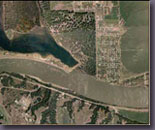
District III has more than nine years of experience in parceling. View map to see regional parcel project activity.
Click here for Interactive Parcel Demo.
COMPREHENSIVE GIS PLANNING & IMPLEMENTATION:
District III will work with local officials to help define specific GIS needs, and subsequently determine an appropriate plan of action. GIS staff will continue to provide hands on assistance through every step of the implementation process to ensure you have a successful GIS program.
E-911
The R3 software (Bullberry Systems, Inc.) that District III uses for E-911 projects can be incorporated with existing 911 and E-911 systems, providing mapping information not normally available to dispatchers, such as aerial photography or topographic maps. District III can produce all the GIS data needed for an enhanced 911 project that will allow dispatchers to utilize:
- Wireless call location (phase I & Phase II)
- Auto/Manual call locating
- Map/Airphoto viewing
- Address locator
- AVL
- Record/Photo 'Hot Link'
- Address Determination
- Outbound Notification
- Lat/Lon Coordinate Locator
|
|
MAP GENERATION
District III has the capability to print maps in a large variety of sizes (up to 3’ x 4’). If you are interested in map printing, please contact Harry at District III for pricing.
RURAL ADDRESSING & MAINTENANCE
District III has addressed over eleven counties in South Dakota, and is currently doing E-911 database maintenance for three counties.
View map
DOT GPS ROAD CENTERLINE DATA COLLECTION & MAINTENANCE
District III is working with the South Dakota Department of Transportation (DOT) on a road data collection project, using GPS and GIS systems. The end result will be new county maps and databases, which describe road conditions and contain the locations of rural buildings and other points of interest. The data from this project will be used to make more accurate base maps for each county.
WEB GIS
GIS applications are moving from desktop computers to internet (web-based) applications. By allowing the public to gain access to public information via web-based applications allows government offices to be more efficient. Government employees (municipal, township, county, state, federal or tribal) along with the general public can access all sorts of public information at their office or in the comforts of their home, without special networking or software. If you have an internet connection you can gain access. Although, you can password protect your site to manage those that have access to information.
MITCHELL MAIN STREET PROJECT
The Mission of Mitchell Main Street and Beyond...
"To maximize the economic potential and to preserve the heritage and sense of place of Mitchell’s historic commercial district by encouraging and facilitating the use of the Main Street Four-Point Approach which emphasizes economic development within the context of historic preservation."
Contact:
Mitchell Main Street and Beyond
400 North Main Street
Mitchell, SD 57301
www.mitchellmainstreet.com
info@mitchellmainstreet.com
The website is not up and running yet, but they have secured the domain.
|
|